Satelite Capabilities Of Emerging Space-Competant States
Gerald M. Steinberg
The military role of space satellites has increased continuously over the past three decades. In the early 1960s, the first reconnaissance satellites were launched by the United States, and the Soviet Union followed within a few years. In addition, military communications, navigation, meteorology and other satellites were developed during this period. By the 1980s, systems such as the Navstar Global Positioning System (GPS), as well as reconnaissance satellites (Keyhole, KH-11, Lacrosse, etc.) were of major importance in the military balance.
Most of this activity has been undertaken by the major powers; the United States, Soviet Union (now Russia), and China. France and the European Space Agency have also devoted considerable resources in this area, such as in the development of the Helios reconnaissance satellite. (The British military space program has been relatively limited, compared to the other major powers.) Until the 1980s, these were the only states with the capability to develop satellites and launch them into orbit. Although commercial launch services allowed many other states to develop civilian satellites, mainly for communications and scientific research, these satellites had little military utility.
However, in recent years, the number of states with indigenous launch capabilities has grown. In addition to the major space powers (US, Russia, China, and the European Space Agency), Japan, India, and Israel have placed satellites into orbit. (In 1967, Australia used a modified US Redstone booster to launch a small satellite, but cannot be said to have an ongoing launch capability. Iraq was also reported to be seeking an independent military space capability, and on December 5, 1989, launched a three-stage Al-Abid missile, but no satellite was placed in orbit.1) Canada, Italy, Britain, Norway, and other advanced industrial states have designed, produced and operated advanced satellite systems that were launched commercially. In addition, Brazil, South Korea, Indonesia, Pakistan and South Africa have developed some independent capability to produce (but not launch) satellites, including imaging and communications systems.
The rate at which different states develop the ability to operate in space has been the subject of many studies and much debate. This debate focuses on two central issues; 1)the military uses of satellite systems and concerns regarding the impact on international stability and potential for an arms race in space, and 2)the degree to which states that are not major space powers or advanced industrialized economies will have access to space capabilities for commercial, technological, and national security purposes.2
Technically, as is frequently noted, there is no clear difference between civil and military satellite systems. Orbital imagers and communications satellites are prime examples of dual-use technologies. As a recent US Congressional Research Service report notes, "The distinction between military and civilian launches is arbitrary to a certain extent, since any satellite can be used for either sector. For example, communication satellites can carry either military or civilian traffic, and navigation satellites are used by both the military and civilian communities."3
The potential military impact of dual-use systems is most salient with respect to imaging and reconnaissance satellites. For many years, the French SPOT (Satellite Pour l'Observation de la Terre) has provided a limited surveillance and imaging capability for states and non-governmental organizations that lack an indigenous capability. Additional systems operated by governments and firms from Russia, the United States, Japan, and potentially, other states, will provide more options and higher resolution in the next few years.
As a result, the importance of military space systems and dual-use satellites in regional conflicts and "emerging space competent states" (second or third tier space nations)4 is likely to increase. As will be discussed in this paper, these capabilities can alter the military balance and stability in a number of regions and conflict systems. However, as will also be demonstrated, the commercial space and imaging platforms of the major (or first tier) space powers are likely to have a far greater impact. The high resolution commercial satellites being developed in the US, Russia, France and Japan, and the competition between them, will be a source of instability in both regional and global conflict systems.5
With respect to the issue of access to space capabilities and technology, as will be seen in this study, in many areas, the number of "emerging space competent states" is growing, despite significant technical and economic obstacles. With the notable exception of India and Israel, the ability of most states to develop a high level of autonomy, including indigenous launchers, has been limited by the international Missile Technology Control Regime (MTCR) and similar measures. Space launcher and missile development programs (which are closely linked and provide another important example of dual-use technology) in Brazil, Argentina, Pakistan and other states have been severely curtailed as a result of these restrictions and the difficulties and costs inherent in obtaining the necessary technology.
However, this trend has been offset to a high degree by an increase in the availability of commercial launch services. In addition to the US and the ESA, Russia and China offer a range of services, and competition between these commercial launchers is intense. Through these services, "emerging space competent states" can contract for the launch of indigenously designed, produced, and operated commercial and research satellites. Thus, access to advanced space capability for many states has actually increased.
I. The Capabilities of Emerging Space-Competant States
For a number of regional powers, the capacity to launch satellites into earth orbit is closely linked to ballistic missile development efforts. Technically, once a state develops an intercontinental or intermediate range ballistic missile (ICBM or IRBM), this can also be used to place a small payload into low earth orbit. (It should be noted that the first satellite launchers used by the major powers were also developed initially as ballistic missiles.) In this way, the economic cost of developing a satellite launcher is largely absorbed by missile development programs, and the space launcher is a low-cost bonus.
While economic, military and strategic considerations provide the primary motivations for the development of indigenous ballistic missiles, space launchers and satellites, national prestige and pride also play an important role. The public visibility of technological achievements in this area is used by governments to gain additional financing for these projects.
However, the technical complexity and high cost of developing these technologies have limited the number of non-OECD states that have succeeded in developing an indigenous space launcher capability to India and Israel. Other states, such as Brazil and perhaps Pakistan, have initiated programs designed to reach this objective, but the high costs and limits placed by the Missile Technology Control Regime, as well as unilateral export controls imposed by the US have slowed or blocked these efforts. This situation is unlikely to change in the next five years.
A. India
India has the most active and advanced space program among the emerging space powers. The Indian Space Research Office (ISRO), based in Bangalore, declares that all of its programs are "intended for peaceful purposes", with specific emphasis on satellite communications and survey of earth resources. Research and development activities related to satellites and launch vehicles are "designed to contribute towards achieving the above goals."6
The Indian space efforts can be traced to a research and development program that began in the early 1950s. In 1975, India built the Aryabhata research satellite which was launched by a Soviet launcher, followed by Bhaskara 1 in 1979, and Bhaskara 2 in 1981. On July 18, 1980 an Indian launcher (the SLV-3) placed a 35 kilogram satellite (Rohini 1) in low earth orbit. As Smith notes, by this achievement, India became the first developing country to launch its own satellite on its own launch vehicle.7 This was followed by the launch of the Rohini 2 on May 31, 1981 (which was in a very low orbit and decayed after 9 days), the Rohini 3 on April 17, 1983 (a 41.5kg. experimental research satellite), the RS-I (Rohini Satellite) and RS-D-I (Rohini Satellite for Development).
In this area, as in other technology-intensive sectors, the Indian government placed a high priority on developing an indigenous capability and overcoming external factors that were deemed to be obstacles to national economic and military development.8 Officially, the 1993 budget of the Indian space program was very small, but this may not include booster development and other costs that are included in the military or other budgets. According to unofficial estimates, between 1980 and 1990, the Indian government allocated $1 billion for space research, including the development of satellites for telecommunications, meteorology, and imaging.9
In contrast to the situation in most other countries, the Indian space launcher did not grow directly out of a ballistic missile development effort. Indeed, the order seems to be reversed, with the missile application following the successful testing of a space booster. Missile development began in earnest in the early 1980s, and in 1983, the Chairman of ISRO indicated that the space program would lead to an IRBM capability.10 Indeed, the Integrated Guided Missile Program led to the development of the Prithvi tactical SSM, with a range of 250km. (first tested in February 1988). The major Indian effort is the Agni IRBM, with a range of 2500km. and a payload estimated at from 1 to 2.5 tons. However, its guidance system, first stage rocket engine and other components were imported.11 The first tests of the Agni took place in 1989, and production is not expected to begin until the late 1990s.
The Indian SLV family has three basic variations; 1) the ASLV (Augmented SLV), which is designed to place a 150kg. payload into a 500km. orbit; 2) the 4 stage Polar SLV, designed for an orbit of 900km.; and 3) a geostationary launcher (GSLV) with a declared payload of 1900kg. The first and third stages of the PSLV use solid propellant, and the second and fourth stages are liquid propellant engines. The GSLV has four additional liquid strap-on motors, and the third and fourth stages are replaced by one cryogenic stage12. Three launch sites are also being built; Sriharikota (the main launch site), Trivadrum, and Balasore.13 The launch vehicle development program has been plagued by a number of failures. An SLV tested failed in 1979, and the first ASLV tests failed in March 1987 and July 1988, but in 1992, succeeded in placing the SROSS-C scientific research satellite into orbit (although here too, the fourth stage of the launcher did not perform optimally and the satellite's orbit was lower than planned). The first flight of the PSLV in September 1993 also failed and an IRS-E satellite was lost, but in October 1994, this system was used successfully to place an IRS-P2 imaging satellite into polar orbit.
In the effort to upgrade its booster capability, India sought to purchase cryogenic engines and technology from Russia in the early 1990s. According to reports, 80% of the "know how" was transferred, but then American pressure on Russia to adhere to the requirements of the Missile Technology Control Regime (MTCR) led Moscow to renegotiate this contract.14
In the area of satellite development, India has active communications and reconnaissance satellite development programs. The first Indian communications satellite, APPLE, was launched in June 1991 by the Ariane launcher. The major Indian effort in this area is concentrated in the INSAT series. INSAT 1A failed to operate properly, but INSAT 1B, built by Ford Aerospace and launched from the U.S. Challenger Space Shuttle in August 1983 was successful (it decayed in 1991). Additional satellites in this series include INSAT 1C (launched by Ariane in 1988), INSAT 1D (launched by a U.S. Delta rocket in 1992).
INSAT 2A was built indigenously by the Indian Space Research Organization (using some imported technology) and launched in July 1992 by an Ariane-4 launcher. In addition to communications technology, this multipurpose satellite also contained a meteorological imaging system. INSAT 2B was launched in July 1993.15 In mid-1995, the upgraded GSLV launcher is scheduled to place a 2,500kg. communications spacecraft into geosynchronous orbit.16 In addition, there are reports that India has contracted for the launch of the Gramsat communications satellite aboard a Russian booster.17
India has also given high priority to the development of imaging satellites. In 1987, a Soviet launcher placed the Indian-built IRS-1A satellite into orbit. This payload includes an monochrome imager with a resolution of 36 meters, and a 73 meter multispectral system.18 The IRS-1B was launched in 1991, and in October 1994, the IRS-P2 earth observation spacecraft was placed in polar orbit. This satellite is equipped with a linear imaging scanner based on an advanced CCD array, providing a resolution of 40m. in 4 spectral bands.19
According to a document of the Indian Space Agency, "Several advanced Indian remote sensing spacecraft are planned as part of a continuing PSLV launch series. These will include Indian multispectral linear arrays with resolutions as high as 10 meters, making them somewhat comparable with current SPOT class spacecraft."20 The IRS-1C, scheduled to be launched by Russia, is expected to have similar characteristics.21 It should be noted that the Indian Space Agency has signed an agreement with EOSAT (a private US firm) to market space images.
According to the Indian government, the imaging satellites are designed for civilian purposes, such as estimating agricultural yields, mapping water resources and for flood monitoring. However, as noted, imaging satellites are dual use systems with military potential. The military focus of the Indian surveillance satellites is apparently Chinese and Pakistani military facilities, including the Kahuta nuclear weapons production complex and the Kanachi naval base.22 India has used aerial reconnaissance for this mission, including the MIG-25 Foxbat B, equipped with five camera ports and with a photographic range of 100km. Manned overflights involve significant risks of interception by aircraft or missiles, while satellites involve no such risks.
B. Israel
Israel, like India, has an advanced scientific infrastructure, and this has led to continuing space-related activity. The Israeli Space Agency (ISA) was founded in 1983, and much of the activity focused on basic research and development, in conjunction with the American and European civil space programs. The ISA's formal budget is very small ($6 million in 1993) but this does not include development and operational costs for the Ofeq and Amos satellites. Israel reportedly spent $1 billion through 1993 on the Ofeq satellite program. Other unverified reports claim that the Defense Ministry allocates $20 million a year for Ofeq, although this seems to be an underestimate.23 (Gross estimates place the cost of development and launch of a first-generation imaging satellite at $400 million.24) Nevertheless, high costs and budgetary limitations delayed the planned launch of Ofeq-3 for as much as two years.
Like other strategic technologies and weapons, the Israeli government provides little official information regarding space launchers and satellites. However, using available information and drawing logical inferences, the outlines of the Israeli program can be discerned. The Shavit (Comet) launchers are apparently based on what is commonly referred to as the Jericho ballistic missile. According to speculation, the Jericho is part of Israel's assured second-strike nuclear deterrent. The Jericho I reportedly carries a payload of 500kg. to a 500km. range, and the more advanced Jericho-2 (in some sources, Jericho-2B or Jericho 3) is estimated to have a range of 1450 to 2800km. and a payload of 1000kg.25 The first two solid rocket engines of the Shavit are manufactured by TAAS (formerly Israel Military Industries), and the third stage motor was designed and produced by Rafael (the Arms Development Research Authority). Israeli Aircraft Industries is the prime contractor.
IAI has sought to recover some of the costs of launcher development through commercial booster services, but with little success. Moshe Keret, IAI's president, blames "political issues" for these obstacles, but claims that these have eased with the Middle East peace process. "Now we have a new opportunity to approach the market, so we will renew our booster marketing efforts."26 However, US missile technology control requirements and the claim that the Israeli launcher is subsidized by the government and military, may continue to block these efforts.27
IAI has announced plans to produce the "Next" launcher, which will be able to place a 300kg. payload into polar orbit. Israel is reportedly planning to enter this launcher in the second phase of NASA's ultralight satellite booster competition. IAI has attempted to create links with US firms (Space Vector and Atlantic Research) to market the Shavit. In this partnership, IAI will provide the first and second rocket motor cases, Rafael will supply the 3rd stage, Atlantic Research will load them with propellant, and Space Vector will integrate and launch the vehicle.28 The NEXT launcher is also being considered for the ELLIPSAT communications satellite system. This 14 satellite system is designed to provide communications for the northern hemisphere. IAI reportedly purchased 10% of the stock in the lead firm, Mobile Communications Holding Inc.29
Early warning and real-time reconnaissance have always been of major importance to Israel defense planners in offsetting the threat to national survival posed by the massive conventional forces of the neighboring Arab states. Israeli defense industries developed a number of mini-RPVs for use as overhead reconnaissance platforms, and these were used extensively during the 1982 Lebanon war.
As part of strategic cooperation with the United States, Israel received sporadic access to American satellite information, (including images of the Entebbe airport used in planning the rescue operation in 1976), but this is not consistent or sufficient.30 Former Chief of Staff Mordechai Gur noted that immediately prior to the 1973 Yom Kippur War, the US withheld critical intelligence information regarding Arab plans to attack. Similarly, Meir Amit, who served as head of the Israeli Mossad, has referred to the 'crumbs' of satellite intelligence that Israel has received, noting that this "is very inconvenient and very difficult".31
Israel security concerns extend to the nuclear, chemical and ballistic missile capabilities being developed by Iran and Iraq. The events prior to the 1991 Gulf War demonstrated the failures of US intelligence with respect to the Iraqi missile and nuclear weapons program, and the inability of the United States to locate and destroy the Iraqi Scud missile launchers during the war increased Israeli focus on obtaining an indigenous capability.32 The Jerusalem Post quoted an Israeli Defense Ministry official as saying that, "For years we have been begging the Americans for more detailed pictures from their satellites and often got refusals - even when Iraqi Scud missiles were falling on Tel Aviv. ...The Americans have also done their best to deny us all help in building our own reconnaissance satellite."33 After the war, Defense Minister Arens explicitly and publicly declared Israel's intention of launching an indigenous reconnaissance satellite.34
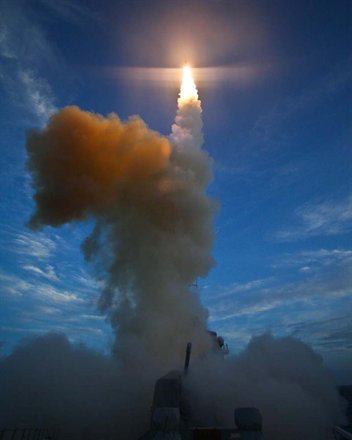
In 1988, Israel launched the Ofeq (Horizon) 1 test satellite, using the Shavit (Comet) launcher. The launch site is on the Mediterranean Coast near Palmachim. To avoid flying over other countries, a highly unusual flight path was used which headed northwest over the Mediterranean, placing the satellite into a retrograde orbit at an inclination of 143 .35 The 156kg. satellite was reported to be a test vehicle designed to lead to the development of an orbital reconnaissance capability, and it reentered Earth's atmosphere in January 1989. Ofeq's orbit limited the satellite's view to areas 37 north and south of the equator. Ofeq 2 was similar in weight and technical characteristics to Ofeq 1. It was launched in April 1990 and had an orbital lifetime of 3 months.36 Both were spin stabilized.
The Ofeq 3, launched April 5 1995, weighed 225kg. at launch, including a 36kg. payload. Its higher perigee (369km.) and orbital maneuvering capability allows for a longer lifetime (one to 3 years). (According to reports in the Israeli press, this version of the Shavit launcher included a small new IAI rocket engine with 674lb. of thrust.37) Its orbit will take it over sites in the Middle East, including Iraq, on most passes during the first months of operation. This version of Ofeq has small thrusters for three-axis stabilization and attitude control with an accuracy of 0.1 degree.38
Officially, the head of the Israeli Space Agency described Ofeq 3 as "a very sophisticated platform on which many things can be placed".39 In particular, Ofeq 3 is reported to be a first-generation imaging satellite, including ultraviolet and visible imaging sensors. Reports that this system could "read license plates in Baghdad" are clearly exaggerated, and for an operational system, Israel will need a number of reconnaissance satellites capable of monitoring various targets. In addition, a data analysis unit to interpret images will require a very large budget. The head of the ISA has noted that Ofeq technology would not replace Israel's request for access to US satellites, particularly in the context of a peace agreement with Syria. In addition, the requirement for an early warning satellite for detecting missile launches would require a geostationary orbit, which is far beyond Israel's current capability.40
A number of Israeli firms have been developing technology for orbital surveillance, including El-Op (camera to photograph 100km. strips to a resolution of 16 meters), Elisra and Tadiran (communications systems), Rafael (thrusters), Elta (antennas), the Dimona nuclear center (vacuum chambers), IAI/Melam (solar cells), IAI/Tamam (gyros and magnometer).41 It is not clear which of this technology is incorporated in Ofeq 3.
In addition to military reconnaissance, IAI and the ISA are also investing in commercial space ventures, (although there are reports that Israel has rejected requests from other states to purchase Ofeq satellites.42) Aby Har-Even, the head of the ISA, has stated that future commercial versions of Ofeq could include sensors, cameras, and communications equipment.43 According to unconfirmed reports, IAI is developing the EROS (Earth Resources Orbiting Satellite) with 2-3 meter resolution capability, and has reportedly signed a contract with Core Software Technology to market these images.44
In the area of communications satellites, Israel is developing the Amos 1, equipped with 7 Ku-band transponders. IAI has signed a contract with Ariane to place this satellite in geosynchronous orbit in December 1995. Amos is a civil commercial satellite developed by IAI at a reported cost of $150 million.45 IAI is reported to be interested in selling future Amos satellites and providing operating services to Asian, Eastern European, and Middle Eastern countries.46 The operating services will be supplied through Satellite Communications Corp. Ltd.47
The Israel Institute of Technology (Technion) is also active in space research and development. Technion students developed the 52kg. Gerwin 1-Techsat (at a cost of $4 million), which was launched in March on a converted Russian SS-25 (Start I) booster, but this launch failed.48 In 1990, the Technion signed an agreement with the USSR for cooperation in scientific engineering and research on x- ray astronomy, planetary exploration, instrumentation, solar-terrestrial physics, earth remote sensing and ecological monitoring.49 The Israel Space Agency signed a government-to-government agreement with Russia in 1993, and the ISA's TAUVEX (Tel-Aviv Ultraviolet Explorer) is expected to be launched on Russia's Spectrum-x/Gamma satellite.
C. Brazil
The Organizing Group of the National Commission for Space Activities (GOCNAE) was created in 1961, in order "to provide Brazil with the infrastructure necessary for the exploration of outer space".50 In 1981 the Brazilian Complete Space Mission (MECB) was created by the federal government to achieve self-sufficiency in space programs. This program is coordinated by the Brazilian Commission for Space Activities (COBAE) and involves both civilian and military bodies (Ministry of Aeronautics, Secretary of Science and Technology). Goals included the production of launch vehicles, and satellites. Before being transferred to civilian authority in 1969, Brazil's space program was part of the Navy, and in the 1980s, according to Karp, its higher echelon was still composed largely of military officers, "suggesting that military applications have not been overlooked".51
In the early 1960s the SONDA sounding rocket series program began at Avibras (a private company that produces most of Brazil's missiles and rockets), which led to the development of Sonda I (2 stage, solid propellant, 75km. range), Sonda II and Sonda III (2-stage solid propelled, 500km. range and 50-160kg. payload). The Sonda 4 rocket was intended to test the major propulsion components of a future space launch vehicle (VLS) and was designed to achieve a range of 600 kilometers with a payload of 500kg.52 The VLS is a four stage rocket designed to place 200kg. in an orbit of 250-1000km. The VLS-R2 reportedly completed a successful test flight.53 In 1989, a one-third size development version of the VLS was tested. The Air Force "Barreira do Inferno" (Hell's Barrier) has been used for Sonda testing, and work has begun on a new launch site for low and geostationary orbit satellites, the Alcantara Launch Centre (CLA), in the State of Maranhao.
However, in the past five years, the pace of development in this area has slowed significantly, and in the 1980's, VLS appropriations dropped from $600m to $170m. In 1989, the Avibras SS-300 ballistic missile project was suspended due to lack of funding, and Avibras declared bankruptcy in 1990 after Iraq refused to pay for artillery ordered during Iran/Iraq War. The National Space Research Institute (INPE) opposed the investment in the VLS and favored less expensive foreign launches. In addition, the Chief of the VLS development, Jayme Boscov, claims that the program was harmed by a US-led technology boycott (the MTCR regime).54
With respect to satellite development, Brazil is most active in the area of space communications. In 1974, Brazil began leasing Intelsat transponders for domestic communications, the second country to do so. The first satellite in the Brasilsat system, SBTS (Sistema Vrasiliero de Telecommunicacoes por Satellite) was launched by Ariane in February 1985 and the second satellite was launched in March 1986. This series of satellites and ground stations was built by Spar Aerospace of Canada and Hughes Aircraft Co. for Embratel, the state-owned telecommunications company.55 These created the basis for developing educational, agricultural and medical TV programming nationwide. Over the years, Brazilian firms have produced the ground stations for this system, and the second generation of Brasilsat is manufactured by Embratel.56 Brasilsat 1 was launched by Ariane on February 8, 1985, and Brasilsat 2 on March 28, 1986. Nine years later, on March 28, 1995, Brasilsat B2, built by EMBRATEL, was successfully orbited by Arianespace.
The Instituto Nacional de Pesquisas Espaciales is active in the design and manufacture of additional satellites. The SCD-1 (Satelite de Coleta de Dados) is a small 115kg. satellite designed to provide weather and climate data, and is used to monitor degradation of the Amazon rain forest. It was placed into orbit in 1993 by an American air-launched Pegasus booster. The INPE is also reportedly in the process of developing three additional satellites in this series to collect environmental data and remote sensing data.57
The Brazilian space agency has also discussed cooperation with other states, including China58 and Russia. In July 1988, Brazil and China signed an agreement (CBERS- China Brazil Earth imaging satellites) for the development of two earth imaging satellites. According to Alves, "The CBERS is aimed at the development of a complete remote sensing system by developing countries which would be both compatible to and competitive with other systems produced and operational during the present decade"59. The first satellite was originally to have been launched in 1993, with a replacement going up in 1995. The status of this project is unknown at this time. In March 1995, a Russian delegation visited Brazil and discussed specific cooperation programs and objectives.60
D. Indonesia
Due to its island geography, Indonesia has sought to develop an extensive satellite communications system, and was the first developing state to operate its own communications satellite (PALAPA A, 1976). The PALAPA B series (with 24 transponders per satellite), manufactured in the United States, and launched by a US launcher, began operation in 1983. The latest satellite, PALAPA B4, was launched in May 1992, and provides communications links for Indonesia, N.Guinea, Malaysia, Philippines, Singapore, Thailand. In the longer term, Indonesia has broader ambitions of becoming a major Asia-Pacific power in the area of technology, including space technology. However, independent launch and satellite development capabilities seem to be many years away.
E. South Africa
Prior to the regime change and election of Nelson Mandella, South Africa had an ambitious space development plan. The indigenous ballistic missile development program provided the basis for the production of an independent satellite launch capability.
Most of the South African effort in the 1980s and early 1990s was concentrated on the development of imaging satellites. Denel Aerospace has designed Greensat, which was initially planned as a military intelligence platform, but following the change in government, became a commercial venture, with an emphasis on environmental monitoring and land management.
As Gupta and other analysts have noted, this platform is clearly a dual use system capable of providing high-resolution military intelligence. According to published reports, the Greensat is to have a 1.8 meter GSD high resolution camera. Current plans call for the launch of GS-01 in late 1995, and a system of 3 satellites ("Greensense") is planned for late 1997 or 1998. (Prospective customers will negotiate for privileged use over certain regions.) The Greensense system will include a SAR (synthetic aperture radar) with the ability to provide images at night through cloud cover or other atmospheric disturbances. According to Gupta, this SAR system will be able to "resolve small structures that act as good electrical conductors or corner reflectors such as vehicles, aircraft, and buildings."61
However, in the wake of the changes in government in South Africa, and the broader political changes in the region, the future of this satellite and system is in doubt. The Mandella government has cut military and defense-oriented spending significantly, and government subsidies for Greensat are likely to be halted. The viability of a purely commercial imaging satellite, operated from South Africa, is questionable.
F. South Korea
South Korea currently operates a small space research program, but like other states, is interested in developing communications and imaging satellites. KITSAT-A is a 50kg. platform that includes a small communications relay and two charge coupled device imagers. It was built by the South Korean Advanced Institute of Science and Technology, in collaboration with the University of Surrey (which designed the platform), and launched by an ESA Ariane launcher in 1992.62
KITSAT-B was placed into polar orbit in September 1993 aboard an Ariane launcher. It is based on the same platform as the KITSAT-1 satellite, and its payload includes an earth imaging and communications systems.63 As South Korea develops its indigenous military technology capability further, it is likely to also expand its space related activities. In the next decade, South Korea can also be expected to develop a local space launch system.
G. Pakistan
The Pakistan Space and Upper Atmosphere Research Commission (SUPARCO), along with the Space Research Council (SRC) are responsible for this nation's space activities and development plans. In the past five years, SUPARCO has overseen the production and testing of sounding rockets, with an average of 3 or 4 launches per year and carrying high altitude and ionosphere research payloads. The 2-stage Shahpar launcher has a payload of 55 kilograms and reaches an altitude of 450 kilometers.64 In 1986, Pakistan contracted for the purchase of missile technology and a launch facility with an American firm (ISC Technologies), at a reported cost of $200-$300m. According to press reports, after 10% of the obligations were paid, Pakistan began to doubt if ISC could provide the assistance that had been anticipated, and apparently no useful technologies were transferred.65
SUPARCO is also active in sponsoring satellite development. The BADR-1 experimental digital communications satellite was launched by a Chinese Long March 2E in July 1990. It weighed 52 kilogram and had an orbital lifetime of 6 months. As in the case of Korea, the design for this micro-satellite was apparently based on the University of Surrey platform.66
As in the case of India and other states, Pakistan is also seeking to develop and operate remote sensing spacecraft. Officially, Pakistan claims to seek this capability in order to obtain data for precise mapping, flood control, pollution, and the location and development of mineral deposits and other natural resources. Despite a small budget ($7.5 million annually), Pakistan developed the BADR-B satellite, which employs a gravity gradient stabilization system, and carries a charge coupled device camera to test image transmission.67
II. Implications of Dual-Use Satellites For Regional Stability
As noted, many space-based and satellite systems are inherently dual-use technologies, with both civilian and military applications. Civil communications satellites can also be applied to military communications, and the information provided by navigation and meteorological satellites can be used by the military for planning maneuvers.68
Remote-imaging, earth observation and surveillance satellites are potentially the most important of these dual-use space systems. Dedicated reconnaissance systems had a major impact on the US-Soviet balance and played an important role throughout the Cold War. They can be used for defensive purposes, to provide early warning and information regarding attacks, as well as offensively through target location and related information. The US used satellite imaging intensively for monitoring events and deployments in the Soviet Union, as well as in regional conflicts. In the 1991 Gulf War, the use of space-based communications and reconnaissance systems were of prime importance to the US-led military effort.69 Similarly, the Soviet Union and, later, China70, developed extensive military reconnaissance capabilities and France is the process of deploying a similar system (Helios).
The intelligence provided by such satellites can be used both as a stabilizing and destabilizing factor. If intelligence strengthens early warning and crisis prevention or resolution, as well as anti-terrorist operations, it has a stabilizing effect. However, if used by an aggressor for target location, damage assessment in the context of attacks, or determination of order of battle, it can be very destabilizing .
The military potential of such satellites also depends on optical resolution, spectrum, orbital features, sun-angle, return time, etc. Of these, resolution is the major factor. In a broad sense, and for military reconnaissance purposes, satellite imaging capabilities can be divided into three categories, according to resolution.
-1)High resolution systems (four meters or less);
-2)Mid-level resolution (ten meters to four meters)
-3)Low-resolution (30 meters to ten meters)71
In general, systems with a GSD of four meters or less are defined as high-resolution imagers and have the greatest utility for intelligence purposes, although the area covered is also minimized.72 Characteristics of weapons systems, damage assessment, and even order of battle, require a resolution of 1 meter or less.73 In this category, the US and Russian military reconnaissance systems have the only currently available systems. The capabilities of the "emerging space competent states", like the commercial systems currently in operation, have significantly less sensitive optics.
Systems with resolutions of from 5 to 10 meters can also provide useful information. The SPOT system is the primary operational example in this category, and constituted the first dual-use imaging satellite.74 (As Krepon notes, while SPOT officials claim that the first-generation satellite "is not suitable for tactical purposes", their marketing efforts "clearly suggest some military applications".75) The first SPOT was launched in 1986, and included a panchromatic imager with a ground resolution of 10 meters, and a multispectral camera with 20 meter resolution. The latest in the series, SPOT 3, was launched in September 1993.
Images obtained from SPOT have been used for many national security-related purposes. For example, SPOT images were used to pressure the German government to end German industrial involvement in the construction of a chemical warfare plant in Rabta, Libya,76 and provided images of the CSS2 missiles Saudi Arabia purchased from China.77 There are indications that Iraq and Iran used SPOT images during their eight-year war.78 SPOT has also been used to obtain information regarding the Dimona nuclear reactor complex in Israel, sites in Iran and Iraq, and in the areas of Serbia and Bosnia.79 In a study involving the use of SPOT for observing military deployments in the Golan Heights, Jasani was able to identify anti-aircraft positions, barracks, perimeter fence locations, aircraft shelters, and other objects.80 SPOT also played an important role in revealing details of the situation at the Chernobyl nuclear reactor complex, and the distribution of these images demonstrated that inaccuracy of the official Soviet statements.81 (SPOT and LANDSAT images were embargoed during the 1990-1991 Gulf War, indicating that these images contained militarily useful information.82)
The Russian Soyuzkarta sells images from the Cosmos KFA-1000 and MK-4 and MFK-6 cameras, with resolutions of approximately 5 meters.83 (Russia also operates the KVR-1000 system, which has the potential of providing images 2 meters or less, but as Gupta notes, this system is also in use by the Russian intelligence community, many of the operating characteristics are unknown, and orders images take several weeks or months before they are filled). In 1978, the US government approved the licensing of commercial LANDSAT systems up to 10 meters resolution, but as of 1995, no such satellites had been built.84 (In 1998, this limit was removed as well.)
The military utility of systems with resolutions of between 30 meters and 15 meters is limited. This category includes LANDSAT (30 meters resolution), the European ERS (SAR 30m resolution), the Japanese JERS-1 (SAR-18m resolution) and the Russian ALMAZ, which uses synthetic aperture radar with a resolution of 15 meters. In addition, the ALMAZ 1, launched in 1991, carries an infrared radiometer with a resolution of 30m.85
Images at these resolutions are useful for detection of large area targets, such as space launching facilities, railroad yards, and coastal features. In 1985, Japanese defense analysts used LANDSAT images to identify improvements to a Soviet air based and to conclude that these improvements would allow the TU-22M Backfire bomber to be flown from this site.86 In addition, Norwegian academics sought to use LANDSAT images, with resolutions of 80 and 30 meters, to detect evidence of the Soviet naval build-up on the Kola Peninsula, with some apparent success.87 (LANDSAT images were also used to identify the oil wells that were ignited by Iraqi forces during their retreat from Kuwait in February 1991.88)
Thus, high-resolution satellite imaging systems with significant military impact still limited to the dedicated satellites of the primary space powers. However, the expected addition of a number of commercial high-resolution satellite imaging systems is likely to change this situation. Wider availability of satellite reconnaissance and space-based imaging, and increased resolution of commercial systems will increase their military impact. Satellite imaging is likely to contribute to instability in a number of regions.
High-resolution commercial imaging satellites, with resolutions under 5 meters, are currently being developed in the US, France, Russia, and Japan, as well as in Israel, and South Africa (as noted above).89 As Gupta notes, "States and political groups that do not have the advanced space systems for acquiring 'spy' satellite imagery will soon have the chance to buy the technological capability they lack."90
For example in 1992, the United Arab Emirates (UAE) submitted an application to purchase an imaging satellite from Litton/Itek. The Israeli government objected, arguing that after denying Israel assistance in obtaining reconnaissance technology, the US seemed to be prepared to supply the Arab countries with binoculars that will "enable them to see every military movement here."91 This was inconsistent with American pledges to guarantee the security of Israel and insure its technological superiority in order to offset the massive Arab quantitative advantage in weapons.92 Although the application was blocked by the US State department, it was endorsed by the space industry and its supporters in the US government.93
More recently, the proposed EYEGLASS project has aroused a great deal of controversy and debate. The EYEGLASS consortium was established in 1994, after the US government reviewed its policy and approved the sale of high-resolution satellite services. The satellite, which is scheduled for launching in 1997, will have a resolution of 1 meter, with potential coverage extending to an area of 14,400 kilometers.94
In late 1994, a Saudi company known as EIRAD acquired a major interest in the EYEGLASS venture, in return for exclusive rights to coverage in the Middle East. In response, the Israeli government expressed concern that this would give the Arabs, including Iraq, access to highly accurate intelligence information and threaten Israeli security and vital interests. In March 1995, the US government decided to study the matter in greater detail and to freeze the project during that period.95 In addition, Litton/Itek, one of American partners in EYEGLASS (since renamed OrbView) dropped out of the consortium, and its future is in some doubt.
A number of additional commercial ventures are planning to offer high-resolution satellite imaging. Earthwatch Inc. has announced plans to orbit a 3 meter system in 1996.96 In 1993, the WorldView Imaging Corporation received a license from the US Department of Commerce for the development of 3 meter resolution commercial imaging satellites, and two are currently under construction.97 Lockheed is developing the Space Imaging Satellite, with a planned GSD of 1 meter, and Alos, being produced by Japan, will have a 2.5 meter resolution.
Implications and Conclusions
While a detailed investigation of the impact of dual-use and dedicated military space systems in emerging space competent states is beyond the scope of this paper, some broad implications can be discerned. In the first place, the major and second-tier space powers - the US, Russia, France/Europe, China, and Japan will continue to be the dominant technological forces in the development and operation of these technologies and capabilities. Indian and Israeli launchers will develop slowly and remain limited with respect to payload and altitude. Due to the high costs and restrictions on technology transfer, other states with objectives aimed at developing space launchers, such as Brazil and Pakistan, are likely to remain earthbound for many years.
However, as noted, this will not limit access to space resources or operational capabilities. The availability of numerous and growing commercial launch services and the competition between them has increased the ability of many states to develop and operate satellite systems for various purposes. This group includes Brazil, Pakistan, South Korea, Indonesia, South Africa. In the next few years, this list is likely to grow.
As demonstrated in this paper, the impact on international security of the dual-use and dedicated military efforts of this group of emerging space competent states is very limited and likely to remain so. To the degree that an "arms race" or a military competition in space can be said to exist,98 it continues to be based on the activities of the first- and second-tier states.
The greatest short term impact of dedicated military space systems and dual-use technologies is in the use of high-resolution dual-use imaging satellites. As De Santis has noted, "given the persistence of territorial disputes and ethnic and religious tensions, ... the use of commercial observation satellites in other parts of the world may be more likely to foster than lessen conflicts in the 3rd world."99 This characterization is particularly true in the Middle East and South Asia regions.
However, as has been demonstrated in this paper, the impact of emerging space-competent states is small compared to first-tier commercial systems such as EYEGLASS (OrbView), improved SPOT, etc. The high costs of producing even limited systems with a few low-power and short-lived satellites will limit the independent capabilities of India, Israel, Brazil, etc. Thus, the impact of the commercial imaging satellite systems on global regional stability over the next decade is likely to be far greater than the systems developed by "emerging space-competent states".
In the spirit of the 1967 Outer Space Treaty, a number of proposals have been presented to limit the military impact of dedicated and dual-use space systems, in general, and of imaging satellites in particular. Some of these proposals are based on "greater transparency and predictability", and other forms of CSBMs in space.100 With respect to imaging satellites, proposals have been presented to create an international regime governing the use of these systems and the distribution of images.101
Strategically, however, space-related military technology and activities are linked directly to other forms of military deployments, both conventional and non-conventional. There is no technical or political basis for separating space technology from other areas or environments for the purposes of arms control and international limitations. This has always been the case for the major space powers (the US and USSR), and is also valid for the emerging space competent states.
The author would like to thank Yehuda Aspler for assisting in the research and writing of this paper.
References:
Newspaper Articles
W. Blitzer, "Pollard: Not a Bumbler, But Israel's Master Spy", Washington Post, Feb. 15, 1987. Alex Doron and Ami Ettinger, "Light Weight Satellite Orbits Earth Every 90 Minutes", Maariv, April 6, 1995. Steve Rodan, "Space Wars", Jerusalem Post Magazine, March 10, 1995. R. Woodward, "CIA Sought 3rd Country Contra Aid" , Washington Post, May 19, 1984. R. Woodward, "Probes of Iran Deals Extend to Roles of CIA Director", Washington Post, Nov. 28, 1986. "Arab States/Israeli Satellite", UPI, Sept. 21, 1988 reprinted in Current News, Sept. 22, 1988, p.3. Ha'aretz, Feb. 5 1993, Nov. 10, 1993, "Riding on a Russian Satellite" Jan. 12, 1994. Sharone Parnes, "Israeli Officials Decline to Discuss Role of Latest Ofeq", Space News April 10-16, 1995. Sharone Parnes, "Israelis Regroup after loss of Satellite on Russian Launcher", Space News, April 3-9, 1995, p.38. Books, Journals: Pericles Gasparini Alves, "Access to Outer Space Technologies: Implications for International Security", (New-York: United Nations, 1992). Pericles Gasparini Alves, "Prevention of an Arms Race in Outer Space: A Guide to the Discussions in the Conference on Disarmament", (New-York: United Nations, 1991). Aviation Week & Space Technology, (July 27, 1992; Aug. 10, 1992; Feb. 21, 1994; Sept. 26, 1994; Oct. 3, 1994; Oct. 17, 1994; Oct. 24, 1994; Nov. 1994). Susan B. Chodakewitz and Louis J. Levy, "Implications for Cross-Border Conflict", in Commercial Observation Satellites and International Security, Michael Krepon, Peter D. Zimmerman, Leonard S. Spector, Mary Umberger eds., (London: Macmillan Press, 1990). Amit Gupta, "Fire in the Sky", Defense and Diplomacy, 8:44-7, October 1990. Vipin Gupta, "METEOSAT Imagery and the Second Gulf War" in John H. Poole and Richard Guthrie, eds., Verification Report 1992: Yearbook of Arms Control and Environmental Agreements (London: Vertic, 1992), pp. 219-229. Vipin Gupta, "New Satellite Images For Sale: The Opportunities and Risks Ahead", Center for Security and Technology Studies, Lawrence Livermore Laboratory, University of California, September 28, 1994. "Military Space: The Warfighter's Edge", International Defense Review, Vol. 28, January 1995, pp. 20-28. B. Jasani, "The Value of Civilian Satellite Imagery", Jane's Intelligence Review, Vol. 5, No. 5, May 1993. Bhupendra Jasani ed., Outer Space: A Source of Conflict or Co-operation?, (Tokyo: UN University Press, 1991). N. Jasentuliyana, "Ensuring Equal Access to the Benefits of Space Technologies for all Countries", Space Policy, February 1994. Aaron Karp, "Ballistic Missiles in the Third World", International Security, Vol. 9, No. 3, Winter 1984/85. Aaron Karp, Ballistic Missile Proliferation: The Politics and Technics, June, 1993. Michael Krepon, "The New Hierarchy in Space", in Commercial Observation Satellites and International Security, Michael Krepon, Peter D. Zimmerman, Leonard S. Spector, Mary Umberger eds.,(London: Macmillan Press, 1990). Thomas G. Mahnken, "Why Third World Space Systems Matter", Orbis, Fall 1991. Vol. 35, No. 4, pp. 563- 579. Laurence Nardon, Satellite Detection, Verification Matters No. 7, Verification Technology Information Centre, November 1994. Martin Navias, Going Ballistic: The Build-up of Missiles in the Middle East, (London: Brassey's, 1993). Y.S. Rajan, "Benefits from Space Technology", Space Policy, August 1988. Jeffrey Richelson, "Implications for Nations Without Space- Based Intelligence-Collection Capabilities", Commercial Observation Satellites and International Security, in Michael Krepon, Peter D. Zimmerman, Leonard S. Spector, Mary Umberger eds.,(London: Macmillan Press, 1990). Hugh De Santis, "Commercial Observation Satellites, Alliance Relations, and the Developing World", Commercial Observation Satellites and International Security, in Michael Krepon, Peter D. Zimmerman, Leonard S. Spector, Mary Umberger eds., (London: Macmillan Press, 1990). John Simpson, Philip Acton, and Simon Crowe, "The Israeli Satellite launch", Space Policy, May 1989. SIPRI Yearbook: World Armaments and Disarmament, (Oxford: Oxford University Press), Annual Volumes 1987-1994. Chris Smith, India's Ad Hoc Arsenal: Direction or Drift In Defense Policy?, (New York: Oxford Univ. Press, 1994). Leonard Spector, "The Not-so-Open Skies", in Michael Krepon, Peter D. Zimmerman, Leonard S. Spector, Mary Umberger eds., Commercial Observation Satellites and International Security, (London: Macmillan Press, 1990). Gerald M. Steinberg, "Israel: Case Study for International Missile Trade and Nonproliferation" in William C. Potter, Harlan W. Jencks eds., The International Missile Bazaar: The New Suppliers' Network, (Oxford: Westview Press, 1993). Gerald Steinberg, "Satellite Reconnaissance: The Role of Informal Bargaining", (New-York: Praeger, 1983). Study on the Application of Confidence-Building Measures in Outer Space, Report by the Secretary-General, (New-York: United Nations, 1993). K. Subrahmanyam, "A View from the Developing World", in Michael Krepon, Peter D. Zimmerman, Leonard S. Spector, Mary Umberger eds., Commercial Observation Satellites and International Security, (London: Macmillan Press, 1990). Raju G. C. Thomas, "India's Nuclear and Space Programs: Defense or Development?", World Politics, Vol. 38, January 1986. Mary Umberger, "Commercial Observation Satellite Capabilities", in Commercial Observation Satellites and International Security, Michael Krepon, Peter D. Zimmerman, Leonard S. Spector, Mary Umberger eds., (London: Macmillan Press, 1990). Peter D. Zimmerman, "Evidence of Spying", Bulletin of the Atomic Scientists, September 1989, pp. 24-5. Peter Zimmerman, "The Use of Civil remote Sensing Satellites During and After the 1990-1991 Gulf War,", in John H. Poole and Richard Guthrie, eds., Verification Report 1992: Yearbook of Arms Control and Environmental Agreements, (London: Vertic, 1992), pp. 230-240. "Space Activities of the United States, Soviet Union and Other Launching Countries/Organizations: 1957- 1993", Congressional Research Service Report to Committee on Science, Space, and Technology, House of Representatives, One Hundred Third Congress, Second Session, (Washington: US Government Printing Office, 1994). Endonotes: 1 "Space Activities of the United States, Soviet Union and Other Launching Countries/Organizations: 1957- 1993", Congressional Research Service Report to Committee on Science, Space, and Technology, House of Representatives, One Hundred Third Congress, Second Session, (Washington: US Government Printing Office, 1994). p.135 (Hereafter referred to as CRS). 2 Pericles Gaspaini Alves, Access to Outer Space Technologies: Implications for International Security, (New- York: United Nations, 1992); Pericles Gasparini Alves, "Prevention of an Arms Race in Outer Space: A Guide to the Discussions in the Conference on Disarmament", (New-York: United Nations, 1991); Bhupendra Jasani ed., Outer Space: A Source of Conflict or Co-operation?, (Tokyo: UN University Press, 1991); N. Jasentuliyana, "Ensuring Equal Access to the Benefits of Space Technologies for all Countries", Space Policy, February 1994. 3 CRS, p.93. 4 In general, the first tier consists of the two major space powers, the US and Russia, which are the only states that are able to produce the full range of launchers and satellite systems. The second tier of states includes those with some, but not all of the capabilities for designing, operating, and launching satellites. This group includes China, France (and the ESA), and Japan. The third tier consists of states with some independent capabilities, including India and Israel, with considerable indigenous programs, and Brazil, Pakistan, South Korea and other states with somewhat lesser local capabilities. The problem of categorization is discussed by Pericles Gaspaini Alves (Access to Outer Space Technologies: Implications for International Security,(New- York: United Nations, 1992), pp. 9-10) and by Edmundo Fujita, in CSBMs and Outer Space Activities, edited by Pericles Gasparini Alves, UNIDIR, forthcoming, pp. 77-8. 5 Satellite systems can also serve to support regional conflict resolution. During the confrontation between the US and Soviet Union, satellite monitoring provided the "National Technical Means" (NTM) for verifying arms control agreements. Similarly, such overhead reconnaissance and NTM could also monitor regional limitation agreements, and can be useful in the context of confidence building measures. (See Gerald Steinberg, Satellite Reconnaissance: The Role of Informal Bargaining, (New-York: Praeger, 1983); Bhupendra Jasani, "Commercial Observation Satellites and Verification", in Michael Krepon, Peter D. Zimmerman, Leonard S. Spector, Mary Umberger eds., Commercial Observation Satellites and International Security, (London: Macmillan Press, 1990), p.142). 6 Report: 1980-81, Dept. of Space, Government of India, p.8. 7 Chris Smith, India's Ad Hoc Arsenal: Detection or Drift in Defense Policy?, (New York: Oxford Univ. Press, 1994), p.201. 8 Raju G. C. Thomas, "India's Nuclear and Space Programs: Defense or Development ?", World Politics, Vol. 38, January 1986, p.339. 9 Ibid. (Thomas). 10 Smith, p.201; Amit Gupta, "Fire in the Sky", Defense and Diplomacy, January 1995. 11 Ibid. (Smith). 12 Pericles Gasparini Alves, Access to Outer Space Technologies: Implications for International Security, p.26. 13 Thomas G. Mahnken, "Why Third World Space Systems Matter", Orbis, Fall 1991. 14 CRS, p.158. 15 CRS, p.158-9; Aviation Week and Space Technology (AW&ST) July 27, 1992; TRW Space Log, 1992, p.11. 16 AW&ST Oct. 24, 1994. 17 CRS, p.158-9. 18 The resolution of a given imaging system is a function of a number of factors, and can vary according to altitude, angle, weather conditions, sun-angle, contrast, etc. In general, the use of this term is based on a standard ground sample distance (GSD) covered by a single pixel. See Vipin Gupta, New Satellite Images For Sale: The Opportunities and Risks Ahead, Center for Security and Technology Studies, Lawrence Livermore Laboratory, University of California, September 28, 1994, p.2. 19 AW&ST October 24, 94; TRW Space Log 1991, p.21. 20 AW&ST October 24,1994; Jeffrey Richelson, "Implications for Nations Without Space-Based Intelligence-Collection Capabilities", in Michael Krepon et al., p. 68. 21 CRS, p.158. 22 Krepon, p.69. 23 CRS p.162; Ha'aretz (Israel) February 5, 1993. 24 Michael Krepon, "The New Hierarchy in Space", in Michael Krepon et al., p.27; Alves estimates the total at $300m (1992 US$) for a "standard earth observation satellite" with a maximum resolution of ten meters. 25 Maariv April 6, 1995; The Non-Proliferation Review, Vol. 2, No. 2, Winter 1995, p.160; John Simpson, Philip Acton, and Simon Crowe, "The Israeli Satellite launch", Space Policy, May 1989. 26 AW&ST, October 17, 1994. 27 Israel has agreed to accept the MTCR guidelines, but is not a formal member of the MTCR. 28 AW&ST Oct. 17, 1994. 29 Ha'aretz August 15, 1994. 30 Jeffrey Richelson, in Krepon, et al., p.67, citing B. Woodward, "CIA Sought 3rd Country Contra Aid", Washington Post, May 19, 1984; Woodward, "Probes of Iran Deals Extend to Roles of CIA Director", Washington Post, November 28, 1986. 31 Jane's Defense Weekly, October 1, 1988 (cited by Richelson in Krepon, et al, p.67). 32 John Kifner, "Israel Launches Space Program and a Satellite", New York Times, September 20, 1988, (cited by Mary Umberger, "Commercial Observation Satellite Capabilities", in Krepon et al., p.13). 33 Michael Rotem, Jerusalem Post, "Spy satellite for Arab Emirates 'serious threat'", November 19, 1992, p.1. 34 Moshe Arens, Broken Covenant. 35 CRS, p.161; Additional thrust is needed to achieve the extra 1200 mph of velocity needed to escape into orbit from a westward launch, this restricted the size of the payload to 156kg. (John Simpson et al., Space Policy, May 1989). 36 CRS, p.161. 37 AW&ST October 17, 1994. 38 IAI Press Release, "OFEQ-3" Technical Data, April 4, 1995. 39 Sharone Parnes, "Israeli Officials Decline to Discuss Role of Latest Ofeq", Space News, April 10-16, 1995. 40 Ibid. 41 Ha'aretz, Nov. 10 1993. 42 Ha'aretz, April 13, 1995, citing Foreign Report. 43 Sharone Parnes, "Israeli Officials Decline to Discuss Role of Latest Ofeq". 44 Steve Rodan, "Space Wars", Jerusalem Post Magazine, March 10, 1995. US officials reportedly agreed to link image distribution policies to the limitation adopted by the US government for US licensed images; Ha'aretz, May 7, 1995. 45 AW&ST October 17, 1994. 46 AW&ST February 21, 1994; AW&ST October 17, 1994. 47 CRS, p.162. 48 The START treaty required the decommissioning of Russian SS-25 missiles, and these are being transformed into commercial space launch vehicles called Start-1 (CRS p.5). 49 CRS, p.162. 50 Alves, Access to Outer Space Technologies: Implications for International Security, p.13. 51 Aaron Karp, "Ballistic Missiles in the Third World", International Security, Winter 84/85, p.183. 52 The Non-Proliferation Review, Vol. 2, No. 2, Winter 1995, p.159. 53 Alves, Access to Outer Space Technologies: Implications for International Security, p.14. 54 IPRI 1990 Yearbook, Ch. 9, Aaron Karp, "Ballistic Missile Proliferation", p.377. 55 asani, "Review of National Programmes", in Bhupendra Jasani ed., Outer Space: A Source of Conflict or Co- operation?, (Tokyo: UN University Press, 1991), p.97. 56 Ibid. 57 TRW Space Log, 1993, pp. 3-4. 58 Krepon in Krepon et al., p.22. 59 Pericles Gasparini Alves, Access to Outer Space Technologies: Implications for International Security. p.16. 60 Andrei Kurguzov, 3/4 TASS 29: APRIL 3 1994 ITAR-TASS. 61 Vipin Gupta, New Satellite Images For Sale: The Opportunities and Risks Ahead, p.12. 62 TRW Space Log, 1992, p.17. 63 TRW Space Log, 1993, p.19. 64 AW&ST Aug. 10, 1992. 65 SIPRI 1991 Yearbook, Ch. 9, Aaron Karp, "Ballistic Missile Proliferation", p.331. 66 Ibid. 67 AW&ST Aug. 10, 1992. 68 See Civil Space Systems: Implications for National Security, Stephen E. Doyle, editor, UNIDIR (Dartmouth: Aldershot, 1994), pp. 81-107. 69 Peter Zimmerman, "The Use of Civil remote Sensing Satellites During and After the 1990-1991 Gulf War", in John H. Poole and Richard Guthrie, eds., Verification Report 1992: Yearbook of Arms Control and Environmental Agreements (London: Vertic, 1992), pp. 230-240; see all remarks by Jeffrey Harris, director of the United States National Reconnaissance Office, at the Space Foundation's 11th Annual Space Symposium, Boulder, Colorado April 6 1995. 70 Through 1993, China had 33 successful launches, orbiting 36 satellites. Most missions were not announced and some were recovered on Earth after a few days, suggesting that they returned film images presumably for military reconnaissance purposes (CRS p.137). 71 For weather information and other large-area features, such as smoke from bombing campaigns, or for tracking large troop movements in the desert, even lower-resolution imaging systems have some military utility. See Vipin Gupta, "METEOSAT Imagery and the Second Gulf War" in John H. Poole and Richard Guthrie, eds., Verification Report 1992: Yearbook of Arms Control and Environmental Agreements, pp. 219- 229. 72 For a detailed analysis of the intelligence implications of different resolutions and other technical characteristics, see Vipin Gupta, New Satellite Images For Sale: The Opportunities and Risks Ahead. 73 Umberger in Krepon, p.10. 74 Other civil space systems, including both US and Soviet manned space flights, produced images that may have been applied to military purposes. However, these were generally not systematic and were not available for purchase, as in the case of SPOT or LANDSAT. 75 Krepon in Krepon et al., p.22. 76 Krepon in Krepon et al., p.21. 77 Richelson in Krepon et al., p.55. 78 Krepon in Krepon et al., p.23. 79 Peter D. Zimmerman, "Evidence of Spying", Bulletin of the Atomic Scientists, September 1989, pp. 24-5. 80 B. Jasani, "The Value of Civilian Satellite Imagery", Jane's Intelligence Review, Vol. 5, No. 5, May 1993. 81 See Krepon in Krepon et al., p.20. 82 Peter Zimmerman, "The Use of Civil remote Sensing Satellites During and After the 1990-1991 Gulf War,", in John H. Poole and Richard Guthrie, eds., Verification Report 1992: Yearbook of Arms Control and Environmental Agreements, pp. 230-240. 83 Vipin Gupta, New Satellite Images For Sale: The Opportunities and Risks Ahead, p.3. 84 Ibid., p.4. 85 TRW Space Log, 1991, p.5. 86 See Richelson in Krepon, p.55. 87 Peter Zimmerman, "Remote Sensing Satellites, Superpower Relations, and Public Diplomacy", in Michael Krepon et al., p.35. 88 Peter Zimmerman, in John H. Poole and Richard Guthrie, eds., Verification Report 1992: Yearbook of Arms Control and Environmental Agreements, pp. 230-240. 89 Vipin Gupta, New Satellite Images For Sale: The Opportunities and Risks Ahead. 90 Ibid., p.2. 91 AWST June 21, p. 80; Ha'aretz, February 5, 1993; Michael Rotem, "Spy satellite for Arab Emirates 'serious threat', Jerusalem Post, November 19 1992, p.1. 92 See Dore Gold, US Policy Towards Israel's Qualitative Edge, (Tel-Aviv: Tel-Aviv University Press, 1992). 93 AWST June 21, p. 80; Ha'aretz, February 5, 1993; Michael Rotem, "Spy satellite for Arab Emirates 'serious threat', Jerusalem Post, November 19 1992, p.1. 94 Vipin Gupta, New Satellite Images For Sale: The Opportunities and Risks Ahead, pp. 14-16. 95 Steve Rodan, "Space Wars". 96 Sharone Parnes, "Israelis Regroup after loss of Satellite on Russian Launcher", Space News, April 3-9, 1995, p.38. 97 Vipin Gupta, New Satellite Images For Sale: The Opportunities and Risks Ahead, p.4, 13-14. 98 Study on the Application of Confidence-Building Measures in Outer Space, p.78. 99 Hugh De Santis, "Commercial Observation Satellites, Alliance Relations, and the Developing World", in Michael Krepon et al., p.83. 100 See Alves, Access to Outer Space Technologies: Implications for International Security, Chapter II. 101 See Vipin Gupta, New Satellite Images For Sale: The Opportunities and Risks Ahead.